
 English
 Follow us


![[Tancar]](/plantilles/bergueda/img/tancar.png)
Volta al Malpàs

Berga-Avià-L’Espunyola-Malpàs-Taravil-Capolat-coll de la Mina-Berga
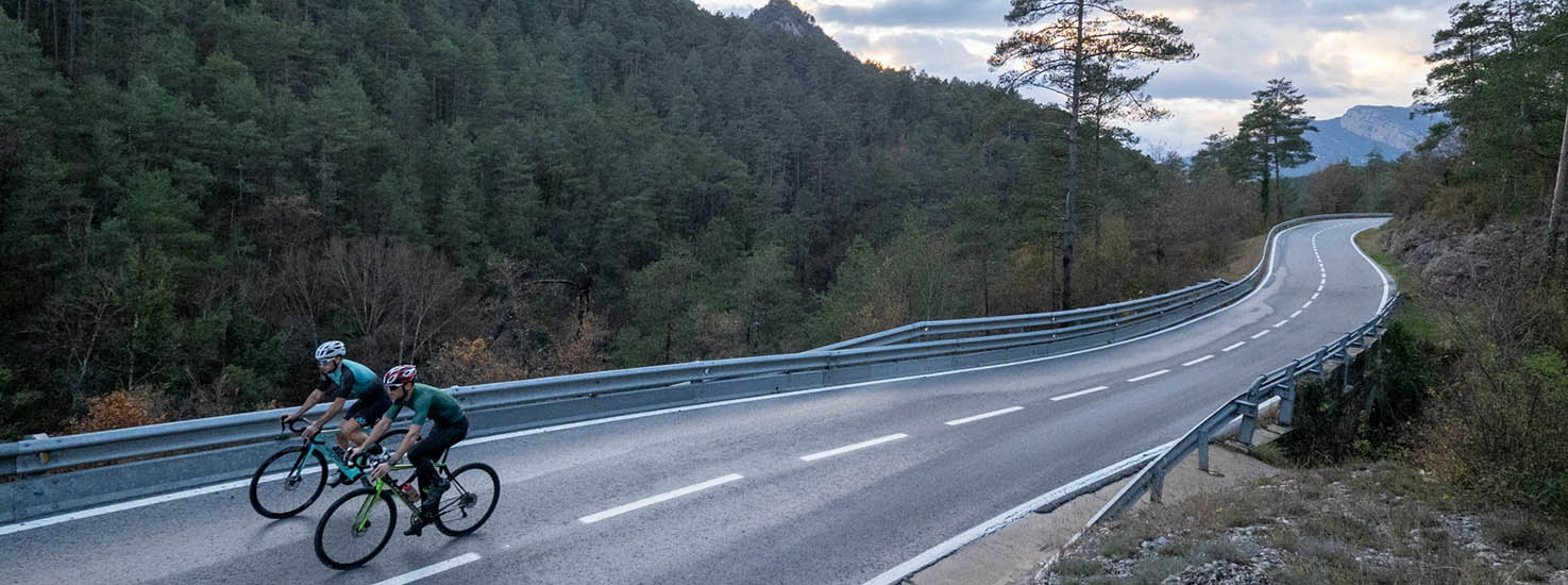
The Mal Pas is a mountain pass that connects the municipalities of Espunyola and Capolat. Its geographical location could lead us to think that it should not generate any type of difficulty but the reality is quite different. It is a relatively short pass -around 5 km- with a total average slope of 8.7% but which has a section that has gradients that reach 20% between the second and third kilometer of ascent and also in the final part, once Mal Pas itself has been passed.
This pass is integrated into this circular route of just over 50 kilometers that makes the route - despite being short - especially tough.
A first section of few oscillations between Berga and Espunyola will help us warm up to face the pass.
The changes in valleys and the mountains that surround them give the entire area great scenic beauty.
Description
The route begins at the car park that we will find at the entrance to Berga sud, at the end of the Passeig de la Pau, at 661 meters above sea level. We will leave in the direction of the Passeig and at the first roundabout -with the Patum emblem- we will take the Sant Fruitós road up. At the top of the street we will turn left in the direction of Valldan. After the neighborhood, we will reach the C-26 road that we will follow for 17 km. We will pass through Avià and l’Espunyola and follow the direction of Cardona. At kilometer point 134 we will reach the Hotel Cal Majoral, where we will leave the main road to turn right onto a paved road that indicates Capolat.
We will continue for a couple of kilometers flat or with a slight climb until the beginning of the port where we will find a sign that indicates it.
We will begin the ascent that is increasingly difficult –especially between kilometers 2-3- until we reach Mal Pas. At this point we will have a light rest to gain strength and undertake the last strong slopes. The last kilometer that will take us to the pass climbs gently across the Taravil plains.
Once we have crowned the summit we will continue towards Taravil, Capolat and Coforb climbing the slight undulations up and down. In Capolat we make a significant change of slope and we begin to see the Lladres and Querat ranges ahead. Before reaching Coforb, however, several short slopes remind us that we are in a mountain area and that we cannot relax yet.
We arrive at the Jouet pass, past the Mina tunnel where we will follow the road to the right towards Berga. A constant descent of 12 km will allow us to return to the starting and ending point of the route without needing to move the pedals practically once.
Technical sheet
Route number: 10
Town: Berga
Type: Middle
Distance: 45 km.
Time: 2,5 hores
maximum altitude: 1308 m.
height difference: 867 m.
Documents and links
OFICINA DE TURISME DEL BERGUEDÀ
Customer service opening hours:
from Monday to Friday from 9 am to 2 pm.
on public holidays falling from Monday to Friday from 10 am to 2 pm.
Tel. +34 654 125 696
E-mail: turisme@elbergueda.cat
![]()
ACKNOWLEDGMENTS

[Premsa]
Other


Follow us


