
 English
 Follow us


![[Tancar]](/plantilles/bergueda/img/tancar.png)
Montgrony

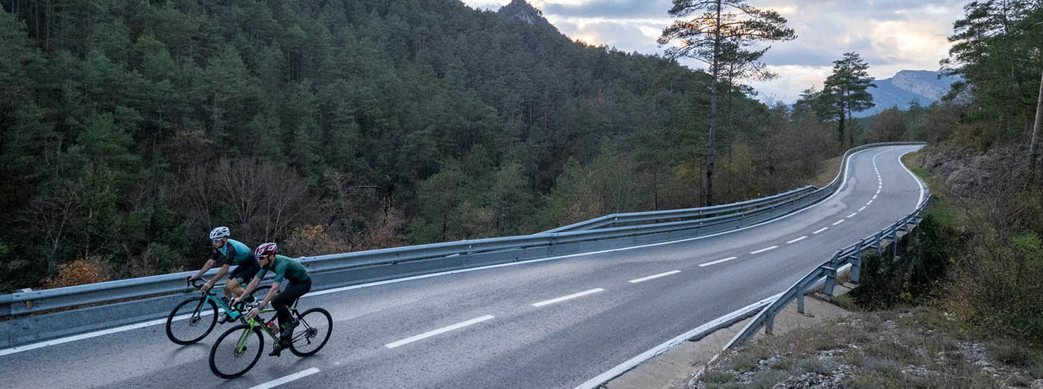
Guardiola de Berguedà-La Pobla de Lillet-Montgrony-Castellar de n’Hug-La Pobla de Lillet-Guardiola de Berguedà
This route will allow us to discover one of the most unknown corners that we find between Berguedà and Ripollès: Montgrony.
Montgrony comes from the word Mogrony but over time and especially due to the use of foreigners it has derived into the word Montgrony. The place name Mogrony comes from the Latin mucronio 'mugró', although foreigners have spread the form Montgrony, contaminated by the word mont 'mountain' present in other similar place names (Montserrat, Montseny, ...).
Montgrony is a small village that belongs to the municipality of Gombrèn where we find the Castle of Montgrony, of great importance for the region and with numerous references to the myth of Count Arnau. Currently, the chapel of Santa Maria de Montgrony and the church of Sant Pere de Montgrony are preserved there.
If this first part of the route is linked to our medieval past, the second part is completely linked to the industrial heritage of the last century, where mines and cement left a strong mark on the Berguedà region, which can now be visited in various tourist resources scattered between Castellar de n’Hug, La Pobla de Lillet and Guardiola de Berguedà.
Description
The route begins in the square of the church of Guardiola de Berguedà, from where we leave on the B-402 towards La Pobla de Lillet, climbing gently along the Llobregat river. We will cross the town and continue on the same road towards the Merolla pass in a gentle but constant climb. Once we have reached the pass, we will begin -with the change in the nomenclature of the road resulting from the change of province- the descent towards Gombrèn on the GI-402, where we will not arrive.
When we reach the Garfull stream, we will take a paved road that goes to the left towards Montgrony. We will start to climb and, after a couple of kilometres, we will leave this road to take one that goes to the left, up, towards the Mataplana castle, which we will pass in a short time. We will continue up until we reach the pass of the Pla de l’Espluga where we will find the refuge of the same name, on the left of the road.
From here we begin a flat stretch that will take us to Castellar de n’Hug to connect with the BV-4031 that we will take to the left towards Castellar de n’Hug and, immediately, to La Pobla de Lillet in a long descent. Once we have reached La Pobla, we will only have to turn right onto the B-400 that will return us to Guardiola de Berguedà, the point where we had started the route.
Technical sheet
Route number: 12
Town: Guardiola de Berguedà
Type: Middle
Distance: 53 km.
Time: 3 hores
maximum altitude: 1388 m.
height difference: 1106 m.
Documents and links
OFICINA DE TURISME DEL BERGUEDÀ
Customer service opening hours:
from Monday to Friday from 9 am to 2 pm.
on public holidays falling from Monday to Friday from 10 am to 2 pm.
Tel. +34 654 125 696
E-mail: turisme@elbergueda.cat
![]()
ACKNOWLEDGMENTS

[Premsa]
Other


Follow us


