
 English
 Follow us


![[Tancar]](/plantilles/bergueda/img/tancar.png)
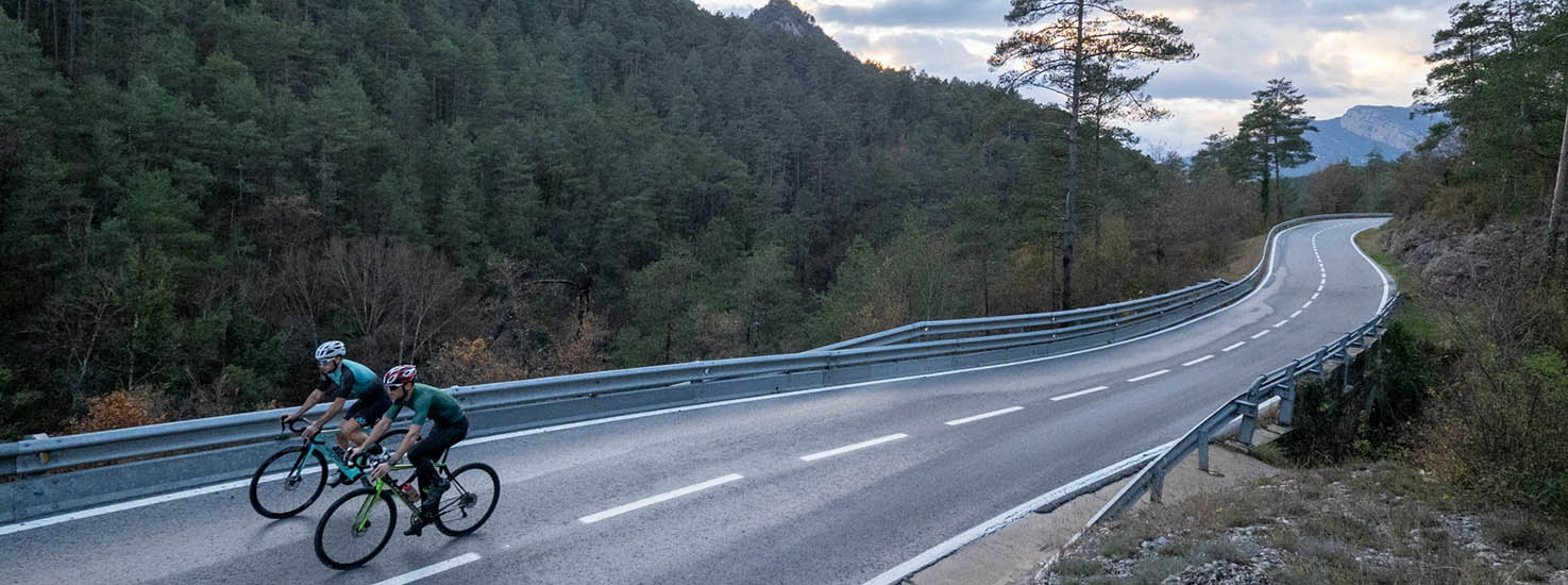
Volta a la Llosa

Berga-Sant Llorenç de Morunys-Navès-Montmajor-L’Espunyola-Avià-Berga
This route offers a wide panorama of the pre-Pyrenean area located between the Llobregat and Cardener rivers.The outward journey takes us through the most mountainous area, through the riu de Valls valley and enclosed by the Queralt and Tossa mountain ranges to the north and the Valielles and Busa mountain ranges to the south.
After following the Llosa del Cavall reservoir from north to south and reaching the Sant Ponç reservoir, we set off on the return journey through a less mountainous area and surrounded by alternating forests and cereal fields.
Description
The route begins at the car park that we will find at the entrance to Berga sud, at the end of the Passeig de la Pau, at 661 meters above sea level. We will leave in the direction of the Passeig, which we will follow up to turn right onto Gran Via Street and then immediately turn left onto Barcelona Street until we turn right again when we reach the Ronda Moreta, the Ribes road and take the C-1411z road to the Coll de Santa Magdalena.
Once at the pass, we will take the BV-4241 towards Sant Llorenç de Morunys. The route begins with the climb to the Coll de Jouet –or Coll de la Mina- in a constant climb of 12 km that ends just past the mine tunnel. A descent will follow to the Pont de Llinars, over the Torrent d'Aiguadora which will take us to change provinces, from here on into Lleida lands. With the change of province the road changes numbering and takes the LV-4241 to Sant Llorenç. From here to the Llosa del Cavall reservoir we connect small climbs with valleys, all of them very rolling.
We cross the Llosa del Cavall reservoir and, without entering the town, we turn left onto the C-462. In any case, it is worth entering Sant Llorenç to stock up on food and drinks to tackle the rest of the route.
We follow the reservoir - we always have it on our right - and continue down, following the course of the Cardener towards Solsona. After about 20 km we will find a roundabout. We will take the third exit onto the same C-462 road until we find the C-26. When we find it, we will not leave it until the end of the route. First we will continue down on the left until we find the beginning of the Sant Ponç reservoir.
We will continue along the same road towards Navès. From here we will begin an alternation of climbs, descents and flat sections to Berga passing through Montmajor, l'Espunyola and Avià, until returning to the point where we had started the route.
Technical sheet
Route number: 03
Town: Berga
Type: Difficult
Distance: 90,31 km.
Time: 5,5 hores
maximum altitude: 1128 m.
height difference: 1797 m.
Documents and links
OFICINA DE TURISME DEL BERGUEDÀ
Customer service opening hours:
from Monday to Friday from 9 am to 2 pm.
on public holidays falling from Monday to Friday from 10 am to 2 pm.
Tel. +34 654 125 696
E-mail: turisme@elbergueda.cat
![]()
ACKNOWLEDGMENTS

[Premsa]
Other


Follow us


