
 English
 Follow us


![[Tancar]](/plantilles/bergueda/img/tancar.png)
03 - La Catllaràs

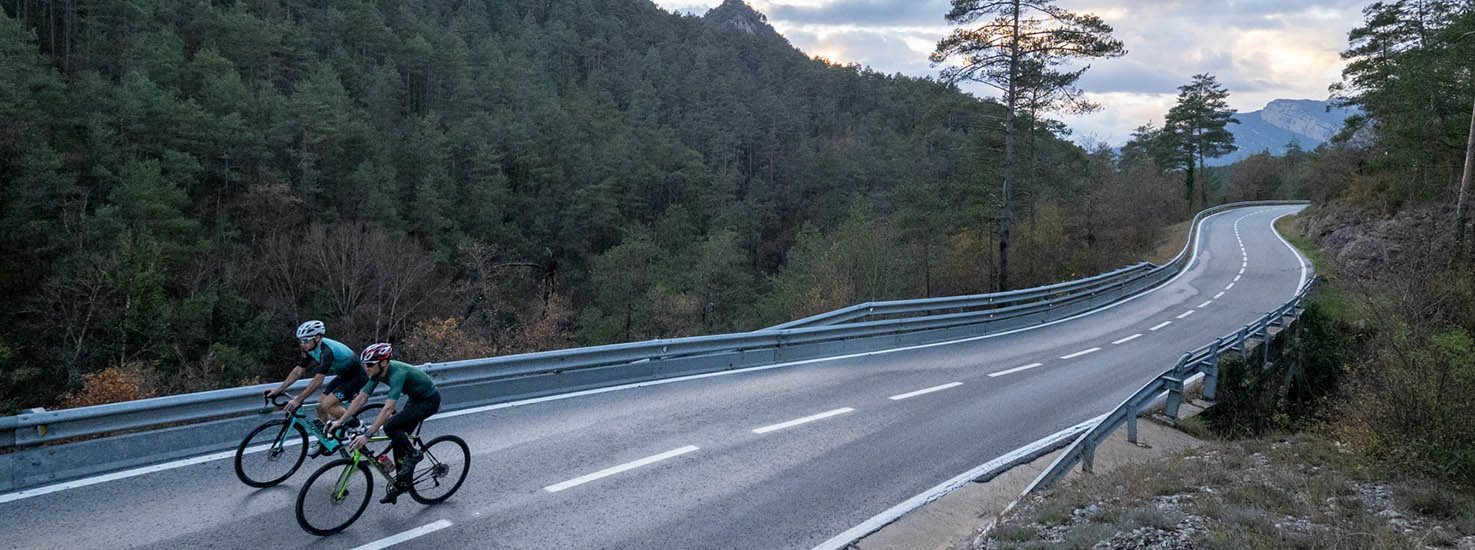
A route to perfectly define the relationship between the suffering of pedaling and, at the same time, enjoying the surroundings. In fact, if you can carry any other object besides the bicycle, it must be a camera. In this case, perhaps a drone would be more appropriate to capture the beauty of the Catllaràs mountain range from above, without forgetting the collection of postcard towns that await us. But let's not be fooled as it is recommended to focus on the route to work our senses and save strength for the hardness of the three ascents that await us.
The first major difficulty of the day is the Coll de Batallola, an irregular port with some rest or even a descent, but also with a very hard final part that we will encounter after passing through Sant Jaume de Frontanyà, one of the tiny towns in the Berguedà with barely more than 25 inhabitants. The second ascent of the day is the ascent to Falgars, despite the fact that we will not finish reaching the Sanctuary since just before we will detour through the Collada Sobirana. Even so, we will have enough time to remember what it feels like to compete in the legendary Escalada a Falgars, a test organized since the 90s by different local clubs and which challenges this climb with several sections that exceed 10%.
Completat el segon port del dia, la part inicial del descens ens portarà a creuar Sant Julià de Cerdanyola, un poble encantador, de menys de 250 habitants i on s’hi cultiva vinya de muntanya, tal i com veurem sense deixar la bicicleta. A Sant Julià, tal i com passa a Bagà, la nit de Nadal s’hi celebra la festa de la Fia-Faia, una tradició gairebé atàvica -reconeguda per la UNESCO-, que celebra el solstici d’hivern baixant torxes de foc de la muntanya fins la plaça del poble. El nostre descens, en canvi, no s’aturarà aquí ja que seguirem per diferents revolts de 180º fins a trobar la C16 on caldrà prendre precaució. Retrobarem la calma a la carretera de Malanyeu on coronarem la Collada de Sant Isidre, després de 5 quilòmetres gairebé al 9% de desnivell mitjà. Baixarem fins La Nou, un poble de menys de 200 habitants, per endinsar-nos per una carretera de fades, per creuar el Pla de Clarà i baixar el conegut com a “Mortirolo berguedà”. És recomanable guardar forces ja que des de l’embassament de la Baells, on haurem arribat de nou, ens quedarà un últim patiment per pujar fins al Castell de Berga. Avui haurà estat un dia dur però la recompensa quedarà guardada a la nostra retina.
Technical sheet
Route number: 03
Town: Berga
Type: Difficult
Distance: 82.65 Km.
maximum altitude: 1232 m.
height difference: 1988 m.
Documents and links
OFICINA DE TURISME DEL BERGUEDÀ
Customer service opening hours:
from Monday to Friday from 9 am to 2 pm.
on public holidays falling from Monday to Friday from 10 am to 2 pm.
Tel. +34 654 125 696
E-mail: turisme@elbergueda.cat
![]()
ACKNOWLEDGMENTS

[Premsa]
Other


Follow us


