Per la Via del Nicolau desde Bagà
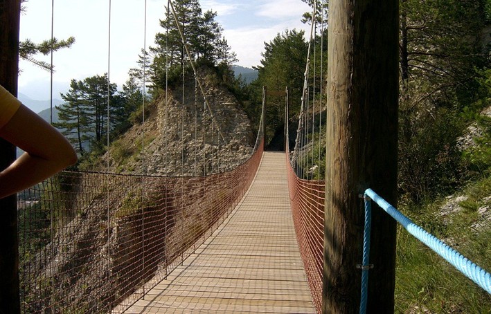
The recovery of the Nicolau road allows a pleasant walk between Guardiola de Berguedà and Sant Joan de l'Avellanet. The path goes into wooded areas, with tunnels and walkways of different types (including a 35m cable). The proximity of the Bastareny River offers an unbeatable view of the valley flanked by the population of Bagà, from where this route proposes to start the route. The return once you visit the monastery of Sant Llorenç, you will head down to Guardiola and Terradelles to return along the main road from Berga to Bagà i Cerdanya.
A little history ...
On April 20, 1914, the railway was started to transport wood between Guardiola and Gisclareny, promoted by Mr. Tomás Nicolau i Prieto, owner of the Berga sawmill. The construction of the route was complicated due to the orography, the harsh weather and the laboriousness of the manual work. Dry stone tunnels and walls were built to consolidate the road.
After several years of operation it was abandoned and a constant degradation of the route began. In the years 1960-1970 the forestry services reopened some sections for hydrology and erosion containment activities. Until 2009 the road was not recovered. This restoration has involved very complex actions, many performed manually or even with the help of a helicopter for transporting materials in practically inaccessible areas.
Description
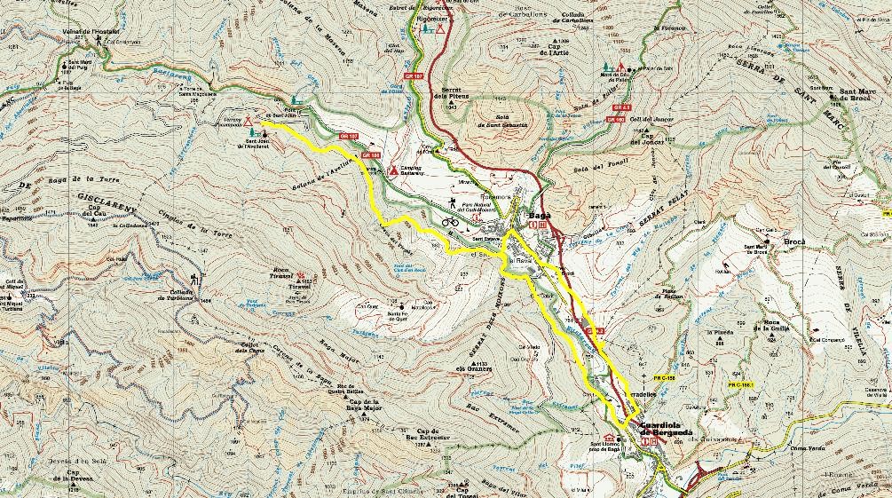
In this case the route begins at the Information Center of the Natural Park of the Cadí Moixeró. After passing through the old laundry room and entering below the La Portella Tower, the beautiful Galceran de Pinós porch square is reached where a plaque recalls the legend of one hundred maidens. The route continues to the door of the church of Sant Esteve and then crosses the Bastareny through the old bridge of the Vila (14th century). You then climb through the Parc de la Vila until you find the paved track of the farm. Follow it still not 100 meters downstream and you will find the signs for the Via del Nicloau. Follow it northwards, Sant Joan de l'Avellanet.
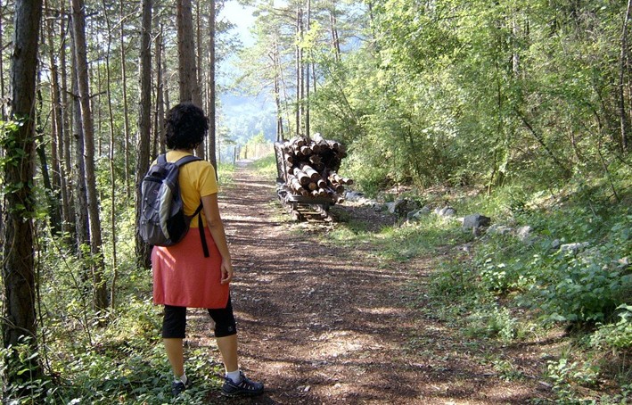
You will immediately realize how flat this path is, it has only a slight slope uphill. so that it can be provided with several walkways, a tunnel dug into the rock and a suspension bridge. With a small final climb with a wooden climb you will reach the asphalted track of the recreational area of Sant Joan de l'Avellanet where you will arrive after following it about two hundred meters on the left. Once you have reached the fountain just at the entrance, go to the hermitage of Sant Joan de l'Avellanet, a small construction of a single nave finished off with a semicircular apse on the east side. The apse is dated to the s. XII but the nave is a reconstruction of the s. XIV.
The proposal is that you follow the track to make the ascent lighter and once visited, you can descend, now by the shortcut path. Again on the track, undo the two hundred meters to take the stairs again, now from the bottom you will be taken back to the old railway line that runs through the forest, now towards Bagà.
When the dirt road ends you will again be where you started the route, near Bagà. Now this asphalted track known as "the path of the old vine" as it approaches the eponymous place, you will follow it to the right. Shortly after passing a tunnel, you have to leave it and take the platform on the old road that goes to the left, and follow it until you reach Guardiola de Berguedà. However, if you wish, before you can follow the track about 100 m up where a sign will indicate access to the Font Cabrit, a lonely and cozy place.
Following the Nicolau road, also equipped with a walkway and benches, it will take you to the Reboll district already in the area of Guardiola de Berguedà. Here the path becomes a paved road. Just before reaching the road, follow the path on the right that goes up to the monastery of Sant Llorenç, a visit is absolutely recommended.
To resume the route, go down the paved road, on the left and you will come to the main avenue of Guardiola de Berguedà. To return to Bagà you have to follow it on the left and after crossing the Bastareny again, continue towards the district of Terradelles once under the C-16 motorway. From here, the path to Bagà is the old royal road that linked Berga and Bagà through the Llobregat valley. On the way you will find forks with several paths to the right that go towards the area of Brocà.
Once in Bagà, follow the street of the suburb and you will again pass the porch square. If you have enough time, before returning to the Information Center of the Natural Park of the Cadí-Moixeró, it is worth a stop to see the wide cultural offer available to the town: mainly, the Medieval and the Cathars center, Sala of the Paintings of the Palace of Pinós, self-guided route through the medieval center and church of Sant Esteve, as well as the center of the Natural Park of the Cadí Moixeró at the end of the route.
Technical sheet
Route number: 32
Town: Bagà
Type: Very easy
Distance: 14 Km
Time: 3,5 hores
maximum altitude: 944 metres
height difference: 375 metres
To organise
Cartography: 46-Parc Natural del Cadí-Moixeró E. 1:25.000. Institut Cartogràfic i Geològic de Catalunya Moixeró - La Tosa 1:25.000. Editorial Alpina
More information
Bibliography: Els trens del Berguedà. Carles Salmerón i Bosch. Inventari de Patrimoni: http://patrimonicultural.diba.cat
Documents and links
OFICINA DE TURISME DEL BERGUEDÀ
Carretera C16 Km 96
08600-Berga. Phone (+34) 654 125 696
Monday to Friday: 9 to 14h.
Saturday: 10 to 14 & 16 to 18h.
Sunday and holidays: 10 to 14h.
E-mail: turisme@elbergueda.cat
[Premsa]
Other

 English
 Follow us


![[Tancar]](/plantilles/bergueda/img/tancar.png)


